Heritage Gateways
Official Sesquicentennial K-12 Education Projectsponsored by the Utah State Board of Education, the BYU-Public School Partnership and the Utah Education Network
Pioneer 1847 Companies
The Pioneer Trek of 1847 - Trek Begins
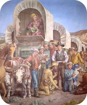
Image courtesy of: This is the Place State Park, This park includes the "This is the Place Monument" and "Pioneer Home and Garden: Old Deseret Living History Museum."
Date: April 19, 1847
The real beginning of the trek of 1847 and the whole trans-Missouri Mormon migration that followed was at 7:30 on the morning of Monday, April 19th. The company moved out from their staging area and the grand adventure began.
As previously noted, the Mormons had prepared themselves for this pioneering venture by studying as much trail literature and as many travel guides as they could, including works by Irving, Fremont, Hastings, Parker, and Long, and had acquired maps by Long, Wilkes, Bonneville, Fremont, and Mitchell. They referred to the maps and accounts en route, to check their location.
The Platte River, rising in Colorado and one of the largest branches of the Missouri, is very broad and shallow, a meandering, braided river that old timers used to say "flowed upside down" -- a reference to the many visible sandbars. One disgruntled pioneer remarked that it would make a pretty good stream if it were turned on its side. Travelers seemed to enjoy thinking up insults for the Platte. The consensus regarding this river was that it was a mile wide, six inches deep, too thick to drink, too thin to plow, hard to cross because of quicksand, impossible to navigate, too yellow to wash in, and too pale to paint with. For hundreds of miles the pioneers hauled themselves across its flat, monotonous plain in what is now Nebraska.
There is some evidence that the pioneers knew in advance that they were going into the Great Basin somewhere near its eastern rim, along the western slope of the Wasatch Mountains. As early as 1842, as previously noted, some claimed Smith said that the Saints would go there, and church leaders had studied Fremont's account and maps of the area. But into which of the several unclaimed valleys? En route, the pioneers consulted with everyone they could about the region, including some famous mountain men--Moses Harris, Jim Bridger, and Miles Goodyear. It appears that as they moved toward and into the Great Basin, they gradually decided to settle in the Valley of the Great Salt Lake.
The camp moved deliberately, casually, about 2 miles an hour (the pace of oxen pulling heavy wagons), and under little pressure. Their best distance for one day was 23 3/4-miles, but they averaged only 10 miles a day. There was no need to get to the mountains before winter snows had melted.
Source: Historic Resource Study - Mormon Pioneer National By Stanley B. Kimball, Ph.D., May 1991. (The study focuses on the history of the trail from its official beginning in Nauvoo, Illinois, to its terminus in Salt Lake City, Utah, during the period 1846-1869. During that time, thousands of Mormon emigrants used many trails and trail variants to reach Utah. This study emphasizes the "Pioneer Route" or "Brigham Young Route" of 1846-1847. The sections on Mormon beliefs and motivations for going west have been omitted. Interested persons can find ample sources for that information. The footnotes, bibliography, maps, pictures, pioneer companies by name and dates for the 22-year period, and historic sites - about 2/3 of the book - have also been left out for space considerations. Thanks to Dr. Kimball and the National Park Service for the availability of this information.)