Heritage Gateways
Official Sesquicentennial K-12 Education Projectsponsored by the Utah State Board of Education, the BYU-Public School Partnership and the Utah Education Network
May Reenactment Photo Album
Previous | Next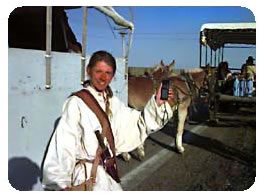 May
13, 1997
May
13, 1997
Location: Cozad, Nebraska
Description:
A modern day pioneer uses global satellite communications to provide precise
position location at all times during the reenactment journey. The original
Mormon pioneers used the stars for celestial navigation during their westward
trek.